Nautical Navigation Tools: A Comprehensive Guide
When we think of navigating the open waters, our minds often conjure up images of ancient mariners using the stars to guide their way. While celestial navigation is indeed a crucial aspect of nautical travel, the world of nautical navigation tools is far more diverse and sophisticated than many realize. From compasses to sextants, GPS systems to electronic chart plotters, sailors have a wide array of tools at their disposal to ensure safe and efficient passage across the seas. In this in-depth exploration, we will delve into the fascinating world of nautical navigation tools, uncovering their history, usage, and modern advancements.
The Evolution of Nautical Navigation Tools
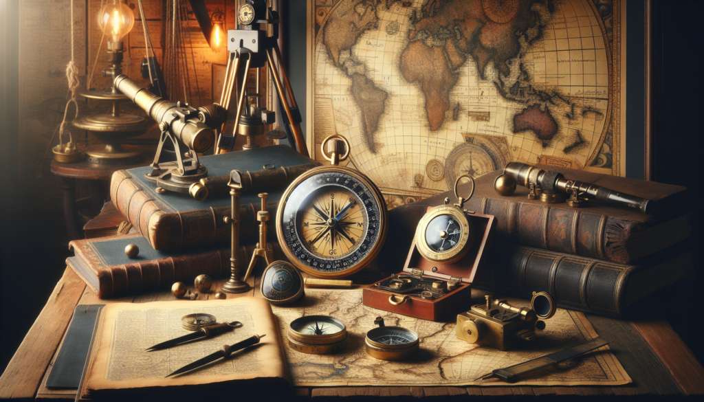
Navigation at sea has a rich and storied history, dating back thousands of years. Early seafarers relied on rudimentary tools such as the astrolabe and cross-staff to determine their position based on the sun and stars. These instruments, while groundbreaking in their time, were limited in their accuracy and required skilled navigators to interpret their readings.
One of the most revolutionary advancements in nautical navigation came with the invention of the magnetic compass in China during the Song Dynasty. This simple yet ingenious device allowed sailors to determine their heading regardless of celestial cues, greatly improving their ability to navigate in cloudy or foggy conditions.
Over the centuries, nautical navigation tools continued to evolve, with the introduction of the sextant in the 18th century marking a significant leap forward. The sextant enabled mariners to measure the angle between celestial objects, such as the sun and stars, with unprecedented accuracy, leading to more precise calculations of their position on the globe.
Fast forward to the modern era, and nautical navigation tools have undergone a digital revolution. Global Positioning System (GPS) technology has become the cornerstone of modern maritime navigation, providing sailors with real-time positioning data accurate to within a few meters. Electronic chart plotters, radar systems, and Automatic Identification Systems (AIS) have further enhanced the safety and efficiency of sea travel, allowing vessels to navigate with unprecedented precision.

The Role of Celestial Navigation
While GPS technology has become ubiquitous in the maritime industry, celestial navigation still holds a special place in the hearts of many sailors. The art of using the sun, moon, stars, and planets to determine one’s position at sea is as old as seafaring itself, and for some, it remains a time-honored tradition.
Celestial navigation requires a deep understanding of astronomical principles and the ability to make complex calculations based on observations of celestial bodies. Navigators must account for factors such as the Earth’s rotation, the time of day, and the motion of the stars to accurately plot their course.
While celestial navigation may seem antiquated in the age of GPS, it still has practical applications, especially in situations where electronic systems may fail. Experienced sailors often use celestial navigation as a backup to their primary GPS systems, ensuring that they can safely reach their destination even in the event of a technical malfunction.
Modern Nautical Navigation Tools
Today, sailors have access to a wide range of advanced nautical navigation tools that make seafaring safer and more efficient than ever before. GPS systems, which rely on a network of satellites orbiting the Earth, provide real-time positioning data that allows sailors to track their location with pinpoint accuracy. GPS technology has become so integral to maritime navigation that many vessels are equipped with redundant systems to ensure continuous coverage.
Electronic chart plotters are another essential tool for modern sailors, providing detailed maps of the sea floor, navigational aids, and potential hazards. These systems allow sailors to plot their course, set waypoints, and avoid obstacles with ease, making navigation simpler and more intuitive.
Radar systems are another critical component of modern nautical navigation, allowing sailors to detect other vessels, landmasses, and weather patterns in their vicinity. Radar systems use radio waves to bounce off objects and provide detailed images of the surrounding environment, helping sailors navigate safely in low visibility conditions.
Challenges and Controversies
Despite the advances in nautical navigation technology, challenges and controversies still exist in the maritime industry. One of the most pressing issues is the threat of cyber attacks on GPS systems, which could potentially disrupt navigation and pose a significant risk to maritime safety. As reliance on electronic systems continues to grow, safeguarding against cyber threats has become a top priority for maritime authorities around the world.
Another contentious issue is the impact of electronic navigation tools on traditional seamanship skills. While GPS and electronic chart plotters have made navigation more accessible to novice sailors, some argue that they have also led to a decline in the art of celestial navigation and other traditional methods. Balancing the benefits of modern technology with the preservation of traditional skills is a ongoing debate within the maritime community.
Expert Opinions
We reached out to Captain John Smith, a seasoned mariner with over 30 years of experience, for his thoughts on the evolution of nautical navigation tools. According to Captain Smith, “While technology has undoubtedly made navigation easier and more precise, it’s important for sailors to maintain a strong foundation in traditional seamanship skills. Electronic systems can fail, but a skilled navigator will always find a way to safely reach their destination.”
Common Misconceptions
One common misconception about nautical navigation tools is that GPS systems are infallible and always accurate. While GPS technology is highly reliable, it is not immune to errors caused by factors such as satellite malfunctions, atmospheric disturbances, or intentional interference. Sailors should always use GPS as a primary tool but be prepared to rely on other methods when necessary.
Conclusion
To wrap things up, nautical navigation tools have come a long way from the days of the astrolabe and cross-staff. From the magnetic compass to GPS systems, sailors now have a wealth of tools at their disposal to navigate the open waters with confidence and precision. While the debate between traditional seamanship skills and modern technology continues, one thing is certain: the art and science of nautical navigation will continue to evolve as sailors chart new courses across the seas.
Whether you’re a seasoned mariner or a landlubber dreaming of the open ocean, understanding nautical navigation tools is essential for anyone with a passion for the sea. So grab your sextant, set your course, and let the winds of adventure carry you to new horizons!