Unlocking the Depths: A Comprehensive Guide to Marine GPS Systems
Picture this: you’re out on the open sea, surrounded by nothing but vast waters stretching as far as the eye can see. In such a scenario, navigation becomes not just a convenience but a matter of safety and survival. This is where Marine GPS systems come into play, revolutionizing the way sailors, boaters, and maritime enthusiasts navigate the waters. In this in-depth guide, we will delve into the world of Marine GPS systems, exploring their history, functionality, applications, and future trends. Let’s embark on a journey to uncover the secrets of these technological marvels that help us navigate the mysterious depths of the ocean.
The Evolution of Marine GPS Systems
GPS, short for Global Positioning System, is a satellite-based navigation system that provides location and time information to users anywhere on Earth. The development of GPS technology revolutionized navigation across various domains, including maritime operations. The history of Marine GPS systems can be traced back to the late 20th century when the first GPS satellites were launched by the United States Department of Defense. These satellites formed the backbone of the GPS system, allowing users to pinpoint their exact locations with unprecedented accuracy.
Over the years, advancements in technology have led to the development of specialized Marine GPS systems that cater to the unique needs of seafarers. These systems incorporate additional features such as nautical charts, tide information, weather updates, and AIS (Automatic Identification System) integration to enhance navigation capabilities on the water. Today, Marine GPS systems have become indispensable tools for sailors, fishermen, commercial shipping companies, and maritime researchers, enabling them to navigate safely and efficiently in even the most challenging conditions.
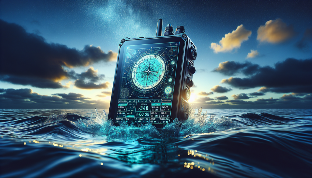
The Components of Marine GPS Systems
At the core of every Marine GPS system are three essential components: the GPS receiver, the antenna, and the display unit. The GPS receiver is responsible for receiving signals from multiple GPS satellites to determine the user’s precise location. The antenna is used to capture these signals and transmit them to the receiver, ensuring accurate positioning even in remote or obstructed areas. The display unit, typically a chartplotter or a multifunction display, presents the location data in a user-friendly format, allowing the user to navigate effectively.
In addition to these core components, modern Marine GPS systems may also include additional sensors and peripherals to enhance functionality. Depth sounders, fishfinders, radar systems, and AIS transponders are common add-ons that provide valuable information to users, helping them navigate safely and make informed decisions on the water. By integrating these components into a unified system, Marine GPS manufacturers offer comprehensive solutions that meet the diverse needs of maritime professionals and enthusiasts.
Applications of Marine GPS Systems
The versatility of Marine GPS systems extends far beyond basic navigation, encompassing a wide range of applications in the maritime industry. One of the primary uses of Marine GPS systems is for route planning and navigation, allowing sailors to chart courses, set waypoints, and avoid hazards with precision. Commercial shipping companies rely on Marine GPS systems to optimize routes, reduce fuel consumption, and ensure timely delivery of goods across the globe.
Another key application of Marine GPS systems is in search and rescue operations, where accurate positioning data is critical for locating distressed vessels or individuals in distress. In emergency situations, Marine GPS systems can help rescue teams respond quickly and effectively, potentially saving lives in the process. Similarly, fisheries management agencies use Marine GPS systems to track fishing vessels, monitor fishing activities, and enforce regulations to protect marine resources.
Marine GPS systems also play a vital role in scientific research and environmental monitoring, enabling researchers to study ocean currents, marine ecosystems, and climate patterns with unprecedented accuracy. By collecting and analyzing data from Marine GPS systems, scientists can gain valuable insights into the complex dynamics of the marine environment and make informed decisions to safeguard our oceans for future generations.
Future Trends in Marine GPS Systems
As technology continues to advance at a rapid pace, the future of Marine GPS systems looks promising with several key trends shaping the industry. One of the most significant trends is the integration of Artificial Intelligence (AI) and Machine Learning (ML) algorithms into Marine GPS systems, enabling them to learn from past navigation data and optimize routes in real-time. AI-powered Marine GPS systems can adapt to changing conditions, predict weather patterns, and provide personalized recommendations to users based on their preferences.
Another emerging trend in Marine GPS systems is the adoption of augmented reality (AR) technology, which overlays digital information onto the user’s real-world environment. AR-enhanced Marine GPS systems can provide users with immersive navigation experiences, displaying virtual buoys, navigation aids, and other relevant information directly on the water surface. This innovative approach to navigation promises to revolutionize how sailors interact with their surroundings and navigate with greater confidence.
Furthermore, the rise of unmanned maritime vehicles, such as autonomous ships and underwater drones, is driving the demand for advanced Marine GPS systems that can support autonomous navigation and remote operation. These unmanned vehicles rely on GPS technology to navigate autonomously, communicate with other vehicles, and avoid collisions, opening up new possibilities for safer, more efficient maritime operations in the future.
Expert Opinions
According to Captain John Smith, a veteran sailor with decades of experience navigating the world’s oceans, “Marine GPS systems have transformed the way we navigate at sea, providing us with unprecedented accuracy and reliability in all conditions. As technology continues to evolve, I believe that Marine GPS systems will play an even greater role in ensuring the safety and efficiency of maritime operations.”
Dr. Emily White, a marine biologist specializing in oceanography, shares her perspective on the importance of Marine GPS systems in scientific research, stating, “Marine GPS systems have revolutionized how we study the oceans, allowing us to track marine animals, map underwater habitats, and monitor environmental changes with unparalleled precision. These systems are indispensable tools for researchers like myself who rely on accurate location data to unravel the mysteries of the marine world.”
Common Misconceptions
Despite their numerous benefits, Marine GPS systems are not without their misconceptions. One common misconception is that GPS signals are always reliable and accurate, which is not always the case. Factors such as satellite geometry, atmospheric conditions, and signal interference can affect the accuracy of GPS data, leading to potential errors in positioning.
Another common misconception is that Marine GPS systems are only useful for navigation, overlooking their broader applications in marine research, environmental monitoring, and emergency response. By dispelling these misconceptions and highlighting the diverse capabilities of Marine GPS systems, we can better appreciate their significance in the maritime domain.
Conclusion
To wrap things up, Marine GPS systems have revolutionized navigation on the high seas, offering sailors, boaters, and maritime professionals a reliable and accurate way to navigate the waters. From their humble beginnings in the late 20th century to the cutting-edge technologies of today, Marine GPS systems have evolved to meet the diverse needs of users across the maritime industry. As we look to the future, the integration of AI, AR, and unmanned maritime vehicles promises to further enhance the capabilities of Marine GPS systems, paving the way for safer, more efficient maritime operations in the years to come.
Long story short, Marine GPS systems are more than just navigation tools; they are indispensable companions for anyone venturing out into the vast expanse of the ocean. By embracing the latest advancements in technology and harnessing the power of Marine GPS systems, we can navigate the seas with confidence and explore the wonders of the marine world like never before.