Nautical Navigation Tools: A Comprehensive Guide
From ancient mariners relying on the stars to modern sailors using sophisticated GPS systems, nautical navigation tools have evolved significantly throughout history. The ability to navigate the vast oceans has always been crucial for explorers, traders, and seafarers alike. In this article, we will delve into the world of nautical navigation tools, exploring their history, significance, and modern-day applications.
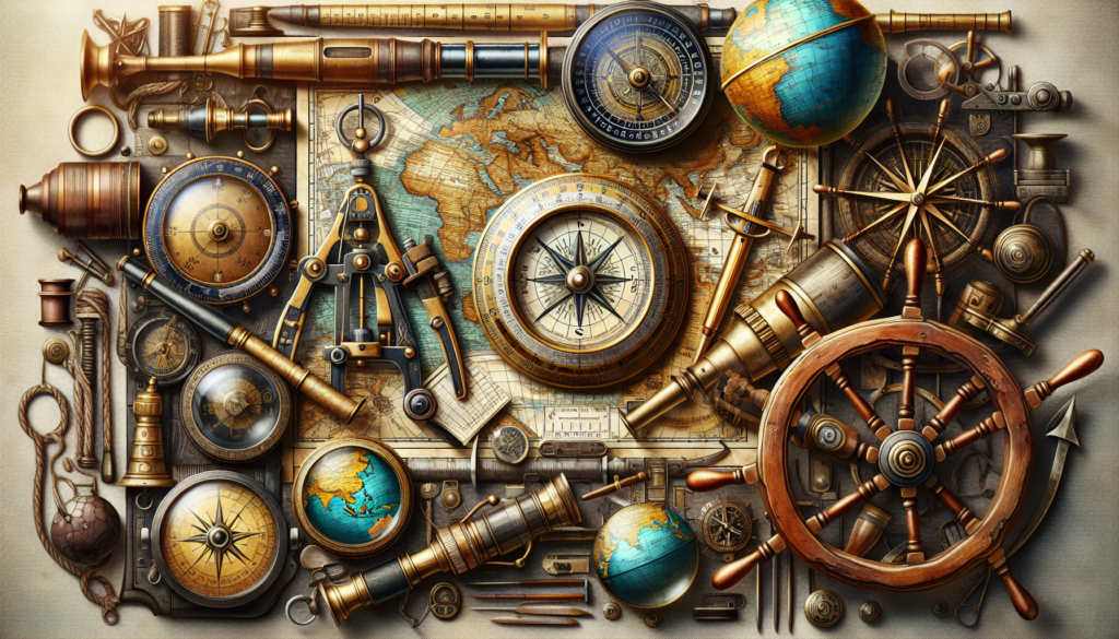
The Compass: A Timeless Navigator
One of the most iconic nautical navigation tools is the compass. Dating back to the 11th century, the compass revolutionized maritime travel by providing sailors with a reliable method of determining direction. Consisting of a magnetized needle that aligns with the Earth’s magnetic field, the compass remains a staple on ships to this day. Its simplicity and accuracy make it an essential tool for navigating the open seas.
Interestingly, the compass played a crucial role in the Age of Exploration, enabling explorers like Christopher Columbus and Ferdinand Magellan to venture into uncharted waters with confidence. Without the compass, these voyages would have been significantly more challenging, if not impossible.
Sextant: Navigating by the Stars
Before the advent of GPS technology, sailors relied on celestial navigation to determine their position at sea. The sextant, a precision instrument used to measure the angle between celestial bodies and the horizon, played a vital role in this method. By taking sightings of the sun, moon, stars, or planets, sailors could calculate their latitude and longitude with remarkable accuracy.
Although the sextant is no longer the primary method of navigation, it remains an important tool for mariners, especially in emergencies when electronic systems fail. Its ability to provide a backup navigation method underscores its enduring importance in the maritime world.
Charts and Maps: Navigational Aids
Accurate charts and maps are essential for safe navigation at sea. From ancient maps drawn by hand to modern electronic chart plotters, these tools provide sailors with critical information about water depths, hazards, and navigational aids such as buoys and lighthouses. Navigating without up-to-date charts is akin to driving without a roadmap a risky endeavor with potentially disastrous consequences.
Advancements in technology have led to the development of electronic charting systems that integrate GPS data with digital charts, offering real-time updates and enhanced navigational capabilities. While traditional paper charts still have their place, electronic chart plotters have become indispensable tools for modern sailors.
GPS: Global Positioning System
The Global Positioning System, or GPS, has revolutionized navigation in ways previously unimaginable. Developed by the United States military, GPS uses a network of satellites to provide precise location and time information anywhere on Earth. For sailors, GPS systems have become indispensable tools for accurate navigation, route planning, and emergency location services.
GPS technology has significantly improved the safety and efficiency of maritime travel, enabling sailors to navigate with confidence even in the most challenging conditions. Its widespread adoption has made traditional navigation methods like celestial navigation and dead reckoning largely obsolete, marking a new era in nautical navigation.
Radar and AIS: Navigational Safety
Radars and Automatic Identification Systems (AIS) are essential tools for ensuring navigational safety at sea. Radars use radio waves to detect objects, landmasses, and other vessels in the vicinity, helping sailors avoid collisions and navigate through adverse weather conditions. AIS, on the other hand, broadcasts a ship’s identity, position, and course information to nearby vessels, enhancing situational awareness and reducing the risk of accidents.
These technologies play a crucial role in modern maritime operations, providing sailors with vital information to make informed decisions and navigate safely in busy shipping lanes and congested ports. By combining radar and AIS data, sailors can navigate with confidence and avoid potentially dangerous situations.
Underwater Sonar: Mapping the Depths
While surface navigation is essential, understanding what lies beneath the waves is equally crucial for safe maritime travel. Underwater sonar systems use sound waves to map the seabed, locate underwater hazards, and identify submerged objects. These tools are particularly valuable for commercial vessels, research ships, and submarines operating in deep waters.
By providing detailed information about underwater topography and potential obstacles, sonar systems help sailors navigate safely and avoid hazards such as rocks, reefs, and wrecks. Their ability to “see” beneath the surface makes them indispensable tools for modern maritime operations.
Weather Instruments: Navigating Stormy Seas
Weather plays a significant role in maritime navigation, with sudden storms and adverse conditions posing a threat to sailors at sea. Weather instruments such as barometers, anemometers, and weather radios help sailors monitor changing weather patterns, anticipate storms, and make informed decisions about route planning and navigation.
By keeping a close eye on weather conditions, sailors can adjust their course, seek shelter, or take other precautions to ensure their safety and the safety of their vessel. Weather instruments are essential tools for any sailor venturing into the unpredictable world of the open ocean.
Conclusion: Navigating the Seas of the Future
In conclusion, nautical navigation tools have come a long way from the days of relying on the stars and the compass. Today, sailors have access to a wide range of sophisticated tools and technologies that make navigation safer, more accurate, and more efficient than ever before. From GPS systems to radar, sonar, and weather instruments, modern mariners have a wealth of resources at their disposal to navigate the seas with confidence.
As we look to the future, it’s clear that nautical navigation will continue to evolve, with new technologies and innovations shaping the way we navigate the world’s oceans. By staying informed about the latest advancements in navigation tools and techniques, sailors can ensure safe passage and successful voyages in the years to come.
Whether you’re a seasoned sailor or a landlubber dreaming of the open sea, the world of nautical navigation tools offers a fascinating glimpse into the art and science of maritime travel. So set sail, explore the vast expanse of the ocean, and navigate the seas with skill and confidence the tools you need are at your fingertips.